


Putnam County PUMA, New York
About
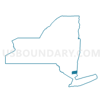
Outline

Summary
| Unique Area Identifier | 193540 |
| Name | Putnam County PUMA |
| State | New York |
| Area (square miles) | 248.21 |
| Land Area (square miles) | 232.21 |
| Water Area (square miles) | 15.99 |
| % of Land Area | 93.56 |
| % of Water Area | 6.44 |
| Latitude of the Internal Point | 41.42790350 |
| Longtitude of the Internal Point | -73.74388160 |
Maps

Graphs
Select a template below for downloading or customizing gragh for Putnam County PUMA, New York


Neighbors
Neighoring Public Use Microdata Area (by Name) Neighboring Public Use Microdata Area on the Map
- Danbury, Ridgefield, Bethel, Brookfield, New Fairfield, Redding & Sherman Towns PUMA, CT
- Dutchess County (North & East) PUMA, NY
- Dutchess County (Southwest) PUMA, NY
- Orange County (Northeast)--Greater Newburgh City PUMA, NY
- Orange County (Southeast) PUMA, NY
- Rockland County (North)--New City & Congers PUMA, NY
- Westchester County (Northeast) PUMA, NY
- Westchester County (Northwest) PUMA, NY
Top 10 Neighboring County (by Population) Neighboring County on the Map
- Westchester County, NY (949,113)
- Fairfield County, CT (916,829)
- Orange County, NY (372,813)
- Rockland County, NY (311,687)
- Dutchess County, NY (297,488)
- Putnam County, NY (99,710)
Top 10 Neighboring County Subdivision (by Population) Neighboring County Subdivision on the Map
- Danbury town, Fairfield County, CT (80,893)
- Cortlandt town, Westchester County, NY (41,592)
- Yorktown town, Westchester County, NY (36,081)
- Carmel town, Putnam County, NY (34,305)
- East Fishkill town, Dutchess County, NY (29,029)
- Ridgefield town, Fairfield County, CT (24,638)
- Fishkill town, Dutchess County, NY (22,107)
- Somers town, Westchester County, NY (20,434)
- Southeast town, Putnam County, NY (18,404)
- Stony Point town, Rockland County, NY (15,059)
Top 10 Neighboring Place (by Population) Neighboring Place on the Map
- Danbury city, CT (80,893)
- Jefferson Valley-Yorktown CDP, NY (14,142)
- Mahopac CDP, NY (8,369)
- Lake Carmel CDP, NY (8,282)
- Carmel Hamlet CDP, NY (6,817)
- Lake Mohegan CDP, NY (6,010)
- Heritage Hills CDP, NY (3,975)
- Putnam Lake CDP, NY (3,844)
- Brewster village, NY (2,390)
- Brewster Hill CDP, NY (2,089)
Top 10 Neighboring Elementary School District (by Population) Neighboring Elementary School District on the Map
Top 10 Neighboring Unified School District (by Population) Neighboring Unified School District on the Map
- Danbury School District, CT (80,893)
- Wappingers Central School District, NY (73,111)
- Haverstraw-Stony Point Central School District, NY (47,775)
- Lakeland Central School District, NY (35,349)
- Carmel Central School District, NY (30,273)
- Beacon City School District, NY (27,294)
- Mahopac Central School District, NY (26,662)
- Ridgefield School District, CT (24,638)
- Brewster Central School District, NY (22,139)
- Somers Central School District, NY (19,543)
Top 10 Neighboring State Legislative District Lower Chamber (by Population) Neighboring State Legislative District Lower Chamber on the Map
- Assembly District 96, NY (138,725)
- Assembly District 90, NY (137,827)
- Assembly District 99, NY (134,814)
- Assembly District 103, NY (134,686)
- Assembly District 102, NY (134,109)
- State House District 111, CT (24,638)
- State House District 138, CT (24,372)
- State House District 108, CT (22,451)
Top 10 Neighboring State Legislative District Upper Chamber (by Population) Neighboring State Legislative District Upper Chamber on the Map
- State Senate District 38, NY (347,376)
- State Senate District 39, NY (332,117)
- State Senate District 41, NY (316,491)
- State Senate District 40, NY (316,324)
- State Senate District 24, CT (104,062)
- State Senate District 26, CT (102,047)
Top 10 Neighboring 111th Congressional District (by Population) Neighboring 111th Congressional District on the Map
- Congressional District 5, CT (714,296)
- Congressional District 4, CT (706,740)
- Congressional District 19, NY (699,959)
Top 10 Neighboring Census Tract (by Population) Neighboring Census Tract on the Map
- Census Tract 102, Putnam County, NY (8,179)
- Census Tract 148.04, Westchester County, NY (8,021)
- Census Tract 118, Putnam County, NY (7,958)
- Census Tract 109, Putnam County, NY (7,771)
- Census Tract 2105, Fairfield County, CT (7,033)
- Census Tract 115, Putnam County, NY (6,817)
- Census Tract 112, Putnam County, NY (6,792)
- Census Tract 136, Orange County, NY (6,763)
- Census Tract 148.06, Westchester County, NY (6,467)
- Census Tract 149.01, Westchester County, NY (6,267)
Top 10 Neighboring 5-Digit ZIP Code Tabulation Area (by Population) Neighboring 5-Digit ZIP Code Tabulation Area on the Map
- 06810, CT (49,482)
- 06811, CT (31,400)
- 10598, NY (28,647)
- 10541, NY (26,339)
- 10512, NY (25,590)
- 12533, NY (25,307)
- 06877, CT (24,677)
- 10567, NY (19,929)
- 12508, NY (19,880)
- 10509, NY (19,507)